|
HOME
CONTACT US
ELECTRICAL
RESISTANCE TOMOGRAPHY
GROUNDWATER
RESOURCES
STRATIGRAPHY
& HYDROGEOLOGY
VOIDS &
SINKHOLES
ARCHAEOLOGY
BURIED MATERIALS
LANDFILLS
CONTAMINANT
PLUMES
MINERAL DEPOSITS
| |

CHARACTERIZE STRATIGRAPHY
 | 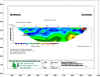 ER
survey showing clay/sand interface conducted to delineate location and migration
paths of non-aqueous phase petroleum hydrocarbons.
ER
survey showing clay/sand interface conducted to delineate location and migration
paths of non-aqueous phase petroleum hydrocarbons. |
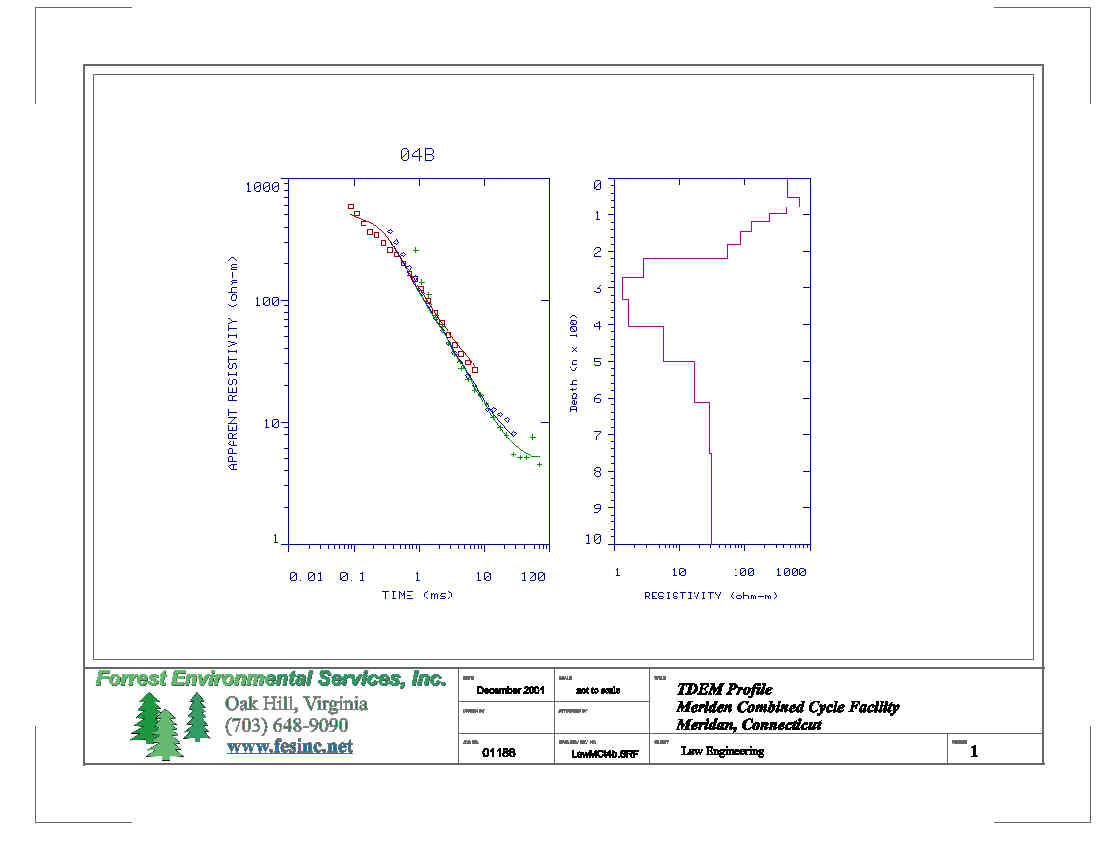
|  TDEM survey was conducted to collect apparent resistivity soundings to 1000
feet for power plant siting.
TDEM survey was conducted to collect apparent resistivity soundings to 1000
feet for power plant siting. |
| ER and Ground Penetrating Radar (GPR), confidential client, Baltimore,
Maryland. The purpose was to define the suspected clay layer located from 20
to 30 feet below ground surface. |
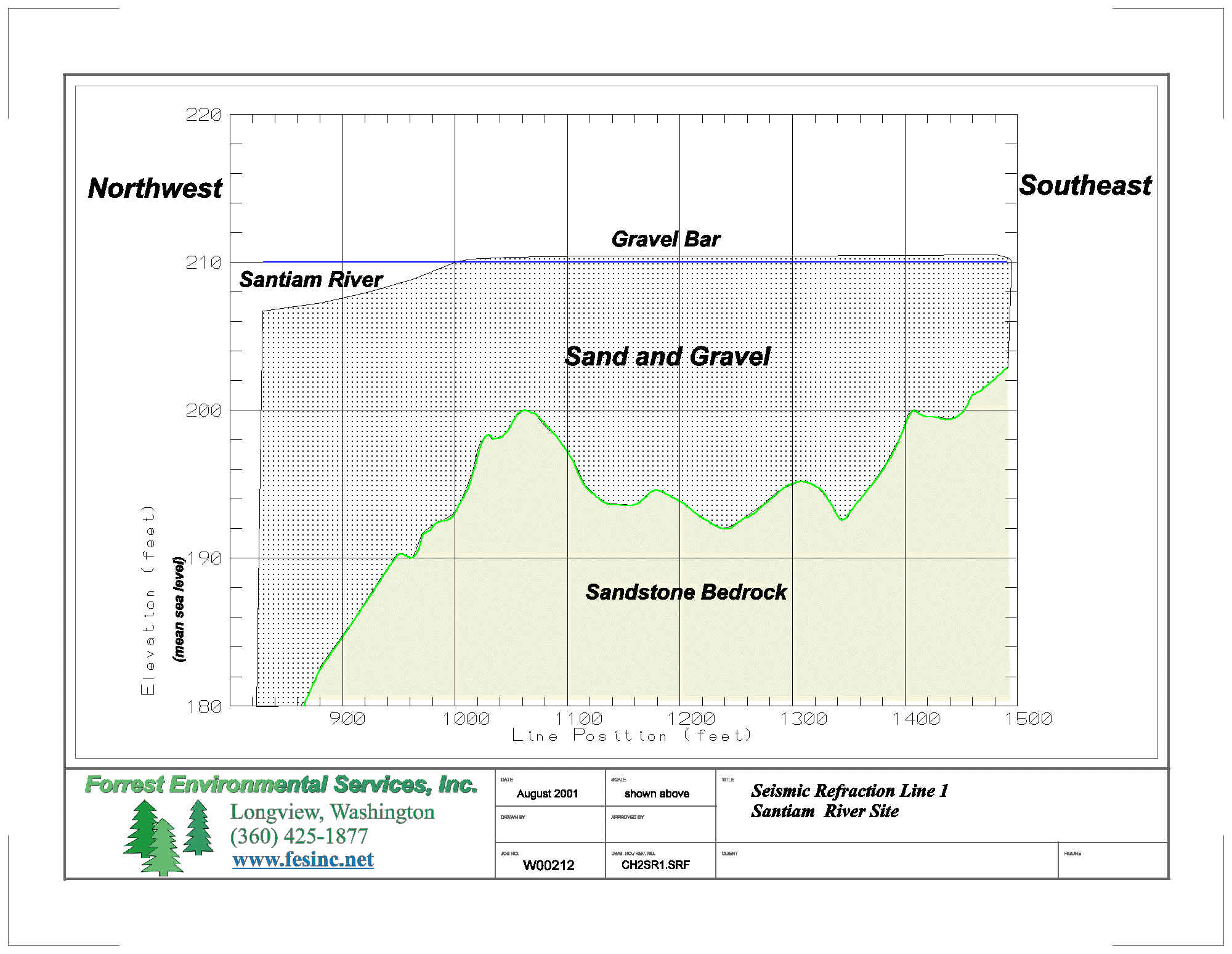
| SR, Georgia Pacific Site and Joshua Falls Energy Center, Lynchburg,
Virginia, and Frederick Energy Facility, Maryland - The purpose was to
determine depth to bedrock, rippability of bedrock, and primary and shear
wave bedrock velocity for proposed plants. |
| SR, Hurt & Proffitt/Appomattox County Landfill, Appomattox, Virginia
and Hurt & Proffitt/Lynchburg Industrial Park, Lynchburg, Virginia - The
purpose to determine depth to bedrock and rippability of bedrock for a
proposed landfill cell location. |
|