|
|
|
ELECTRICAL RESISTANCE TOMOGRAPHY
|
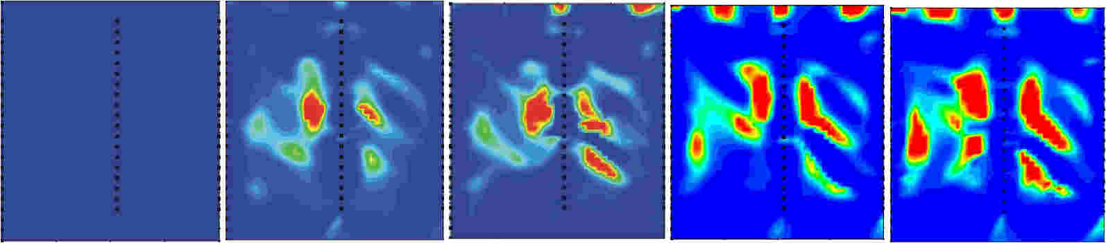
Forrest Environmental Services, Inc has used Electrical Resistance Tomography (ERT) methods to both characterize subsurface hydrogeology and to monitor the migration of heated fluid and steam at thermal remediation sites. The ERT method is well suited to subsurface mapping of changes in temperature, fluid saturation, and fluid electrical conductivity. The ERT method involves the permanent placement of a vertical array of electrodes either within a borehole or within the annular space of a non-metallic cased well boring. ERT data between two or more boreholes is collected with an earth resistivity meter programmed with a transmitter and receiver array designed to optimize data collection. The collected data is subjected to a resistivity inversion modeling procedure to produce an image displaying the distribution of resistivity between boreholes. Changes in resistivity over time are produced by comparing the background resistivity distribution to subsequent resistivity values. Through this method, changes that occur due to the injection of heated fluid or steam can be tracked over time. Example of Time-Lapse ERT Thermal Remediation in Fractured Rock
|